Distance Calculator

I 80, I 90

4682.2 km, 52 h

Head southwest on Harman Street90 m
Turn right onto Bushwick Avenue2.5 km
Turn left onto Grand Street900 m
Continue onto Borinquen Place700 m
Take the ramp towards Williamsburg Bridge250 m
Merge left onto Williamsburg Bridge250 m
Keep left onto Williamsburg Bridge2 km
Continue onto Delancey Street800 m
Continue onto Kenmare Street350 m
Turn left onto Lafayette Street70 m
Turn right onto Broome Street450 m
Continue onto Watts Street250 m
Take the ramp towards I 78: Holland Tunnel100 m
Merge left onto Holland Tunnel (I 78)3 km
Continue onto 14th Street (I 78)700 m
Keep left towards NJ 139 West: Pulaski Skyway500 m
Continue onto NJ 139 Lower Level (NJ 139)1 km
Continue onto Pulaski Skyway (NJ 139)150 m
Take the ramp towards US 1-9 Truck: Newark800 m
Merge left onto US 1-9 Truck (US 1 Truck)600 m
Keep left onto NJ 74 km
Take the ramp towards I 280 West1.5 km
Merge right onto Essex Freeway (I 280)25 km
Keep left towards I 280 West700 m
Merge right onto Christopher Columbus Highway (I 80)35 km
Keep left onto Christopher Columbus Highway (I 80)40 km
Keep left onto I-80 (Open Road Tolling)350 m
Merge right onto I 8090 m
Keep left onto I 808 km
Keep left onto I 8020 km
Keep left onto I 80500 km
Keep right onto I 807 km
Take the ramp towards I 80 West800 m
Keep right towards I 80 West: Cleveland700 m
Merge left onto Ohio Turnpike (I 80)350 km
Continue onto Indiana Toll Road (I 80)250 km
Continue onto Chicago Skyway (I 90)10 km
Keep left towards I 90 Express600 m
Merge left onto Dan Ryan Expressway (Express) (I 90)10 km
Continue onto Kennedy Expressway (I 90)15 km
Take exit 43C towards Montrose Avenue300 m
Keep left towards Montrose Avenue50 m
Turn left onto West Montrose Avenue1 km
Turn right onto North Milwaukee Avenue2 km
Turn left onto North Northwest Highway1.5 km
Make a slight left onto West Bryn Mawr Avenue3 km
Continue onto West Higgins Road (IL 72)5 km
Turn right15 m
Take the ramp on the left towards I 90 Toll West400 m
Merge left onto Jane Addams Memorial Tollway (I 90)150 km
Take exit 183 towards CTH S550 m
Keep left at the fork70 m
Turn left onto Shopiere Road (CTH S)1 km
Turn right onto East Inman Parkway (CTH BT)2.5 km
Turn right onto Prairie Avenue (CTH G)1 km
Continue onto County Highway G (CTH G)8 km
Turn right onto WI 112.5 km
Take the ramp on the left onto WI 1125 km
Continue onto I 3980 km
Keep left onto I 90100 km
Keep left towards I 90 West: Tomah80 km
Keep left onto I 901000 km
Take the ramp towards SD 34 West: Whitewood450 m
Turn right onto SD Highway 34 (SD 34)30 km
Turn right onto 5th Avenue (US 85)4 km
Turn left onto US Highway 212 (US 212)150 km
Turn left onto Holt Street (US 212)70 km
Continue onto US Highway 212 (US 212)30 km
Enter the traffic circle and take the 2nd exit onto US Highway 212 (US 212)70 m
Exit the traffic circle onto US Highway 212 (US 212)70 km
Take the ramp150 m
Continue onto US 212150 km
Continue onto I 90350 km
Keep left towards I 90 West: Missoula500 km
Keep left onto I 9090 km
Keep left onto I 90350 km
Take exit 10 towards I 405: Renton350 m
Keep right towards I 405 North: Everett700 m
Merge left onto I 40530 km
Take the ramp towards I 5 North: Everett900 m
Merge left onto I 580 km
Take the ramp towards SR 20: Anacortes700 m
Turn right onto West Rio Vista Avenue (WA 20)400 m
Turn left onto South Burlington Boulevard (WA 20)450 m
Turn right onto East Fairhaven Avenue600 m
Turn left onto Cascade Highway1 km
Continue onto North Cascades Highway (WA 20)6 km
Continue onto Borseth Street (WA 9)100 m
Enter the traffic circle and take the 1st exit onto Borseth Street (WA 9)40 m
Exit the traffic circle onto Borseth Street (WA 9)350 m
Continue onto West Moore Street (WA 9)100 m
Enter the traffic circle and take the 1st exit onto West Moore Street (WA 9)35 m
Exit the traffic circle onto West Moore Street (WA 9)800 m
Turn left onto North Central Street60 m
Turn left55 m
You have arrived at your destination, on the right0 m

I 70, I 44

5328.0 km, 60 h

Head southwest on Harman Street90 m
Turn right onto Bushwick Avenue2.5 km
Turn left onto Grand Street900 m
Continue onto Borinquen Place700 m
Take the ramp towards Williamsburg Bridge250 m
Merge left onto Williamsburg Bridge250 m
Keep left onto Williamsburg Bridge2 km
Continue onto Delancey Street800 m
Continue onto Kenmare Street350 m
Turn left onto Lafayette Street70 m
Turn right onto Broome Street450 m
Continue onto Watts Street250 m
Take the ramp towards I 78: Holland Tunnel100 m
Merge left onto Holland Tunnel (I 78)3 km
Continue onto 14th Street (I 78)700 m
Keep right towards NJTP: New Jersey Turnpike15 km
Keep right onto New Jersey Turnpike Newark Bay Extension (I 78)70 m
Continue slightly left onto Phillipsburg-Newark Expressway Tolls (I 78)100 m
Keep right onto Phillipsburg-Newark Expressway (I 78)15 km
Keep left towards I 78 West: Clinton250 m
Merge left onto Phillipsburg-Newark Expressway (I 78)80 km
Keep left towards Express E-ZPass Only35 km
Keep left towards I 78 West: Harrisburg90 km
Continue towards I 81 South: Harrisburg1 km
Merge left onto I 8160 km
Take exit 52 towards US 11: New Kingstown450 m
Keep right towards US 11 South60 m
Merge left onto Harrisburg Pike (US 11)1.5 km
Take the ramp towards I 76700 m
Keep right towards I 76 West: Pittsburgh400 m
Merge left onto Pennsylvania Turnpike (I 76)250 km
Take the ramp towards I 70 West: Greensburg700 m
Keep right towards I 70 West: New Stanton100 km
Keep left towards I 470 West: Columbus OH5 km
Continue onto Vietnam Veterans Memorial Bridge (I 470)15 km
Merge left onto I 70450 km
Keep right towards I 70: St Louis250 km
Keep right towards I 70 West: Saint Louis100 km
Keep left towards I 55 South: Saint Louis25 km
Keep left towards I 55 South: Louisville1 km
Merge left onto I 551.5 km
Keep right towards IL 3 South: Cahokia2.5 km
Keep right towards I 44 West: Tulsa2 km
Keep right onto I 4420 km
Continue onto Henry Shaw Ozark Corridor (I 44)450 km
Continue onto George Washington Carver Memorial Highway (I 44)15 km
Take exit 1 towards US 166 West: Baxter Springs250 m
Keep left towards South Outer Road45 m
Turn right onto US 166350 m
Enter the traffic circle and take the 2nd exit onto US 16650 m
Exit the traffic circle onto US 16615 km
Turn right onto US Historic 663 km
Enter the traffic circle and take the 2nd exit onto US 69 Alternate50 m
Exit the traffic circle onto US 69 Alternate10 km
Continue onto US 6920 km
Turn left onto US 400100 km
Enter the traffic circle and take the 2nd exit onto Clayton J. Connell Memorial Highway (US 400)50 m
Exit the traffic circle onto Clayton J. Connell Memorial Highway (US 400)100 km
Continue onto Vietnam Veterans Memorial Highway (US 54)10 km
Continue onto East 7th Avenue (US 54)1 km
Continue onto Vietnam Veterans Memorial Highway (US 54)15 km
Take the ramp towards I 35: Kansas Turnpike450 m
Continue onto KS 9615 km
Keep right towards I 135 North: Salina3.5 km
Continue onto I 13530 km
Continue onto I 1353.5 km
Continue onto I 135100 km
Take the ramp towards I 70 West: Hays350 m
Merge left onto Dwight D. Eisenhower Highway (I 70)700 km
Take exit 289 towards E-470: Colorado Springs500 m
Turn right towards E-470 North200 m
Take the ramp towards E470 Toll North600 m
Merge left onto E-470 (E470)40 km
Take exit 47 towards I 25: Denver500 m
Keep right towards I 25 North: Fort Collins800 m
Merge left onto Dwight D. Eisenhower Highway (I 25)90 km
Take exit 281 towards Owl Canyon Road400 m
Turn left onto East County Road 70 (CR 70)10 km
Enter the traffic circle and take the 1st exit onto North County Road 19 (CR 19)20 m
Exit the traffic circle onto North County Road 19 (CR 19)2 km
Continue onto West County Road 72 (CR 72)6 km
Turn right onto North Highway 287 (US 287)35 km
Continue onto US Highway 287 (US 287)35 km
Continue onto South 3rd Street (US 287)2.5 km
Take the ramp900 m
Merge left onto Dwight D. Eisenhower Highway (I 80)550 km
Take the ramp towards I 84 West: Ogden500 m
Continue onto I 84100 km
Keep left onto I 84150 km
Merge right onto I 86500 m
Continue onto Vietnam Veterans Memorial Highway (I 84)300 km
Continue onto Vietnam Veterans Memorial Highway (I 84)350 km
Take the ramp towards US 395 North: Stanfield500 m
Turn right to stay on Umatilla-Stanfield Highway (US 395)2 km
Continue onto South Main Street (US 395)3.5 km
Continue onto Umatilla-Stanfield Highway (US 395)5 km
Turn right onto Southeast 4th Street2.5 km
Turn left onto East Theater Lane400 m
Turn right onto North 1st Street (US 395)900 m
Continue onto Umatilla-Stanfield Highway (US 395)6 km
Turn left onto 6th Street (US 395)1 km
Take the ramp towards I 82 West: Kennewick350 m
Merge left onto McNary Highway (I 82)2.5 km
Take the ramp towards SR 14: Plymouth450 m
Turn left onto Lewis and Clark Trail Highway (WA 14)20 km
Turn right onto WA 22140 km
Turn right onto State Highway 22 (WA 22)900 m
Turn right onto Wine Country Road (WA 22)500 m
Take the ramp on the right500 m
Merge left onto I 8280 km
Continue onto I 8250 km
Keep left towards I 90 West150 km
Take exit 10 towards I 405: Renton350 m
Keep right towards I 405 North: Everett700 m
Merge left onto I 40530 km
Take the ramp towards I 5 North: Everett900 m
Merge left onto I 580 km
Take the ramp towards SR 20: Anacortes700 m
Turn right onto West Rio Vista Avenue (WA 20)400 m
Turn left onto South Burlington Boulevard (WA 20)450 m
Turn right onto East Fairhaven Avenue600 m
Turn left onto Cascade Highway1 km
Continue onto North Cascades Highway (WA 20)6 km
Continue onto Borseth Street (WA 9)100 m
Enter the traffic circle and take the 1st exit onto Borseth Street (WA 9)40 m
Exit the traffic circle onto Borseth Street (WA 9)350 m
Continue onto West Moore Street (WA 9)100 m
Enter the traffic circle and take the 1st exit onto West Moore Street (WA 9)35 m
Exit the traffic circle onto West Moore Street (WA 9)800 m
Turn left onto North Central Street60 m
Turn left55 m
You have arrived at your destination, on the right0 m
From
    To

      Distance: 2,394.99 mi (3,854.36 km)

      Driving route: 2909.37 mi (4682.16 km).

      Driving time: 52h 17 min

      Distance from Sedro-Woolley to New York

      The shortest distance (air line) between Sedro-Woolley and New York is 2,394.99mi (3,854.36 km)

      The shortest route between Sedro-Woolley and New York is 2909.37 mi (4682.16 km) according to the route planner. The driving time is approx. 52 h 17 m

      How far is it between Sedro-Woolley and New York.

      Sedro-Woolley is located in Washington, United Statescountry within 48° 30' 40.32" N -123° 46' 4.44" W (48.5112, -122.2321) coordinates. The local time in Sedro-Woolley is 08:18 (11.08.2025)

      New York is located in New York, United Statescountry within 40° 41' 39.48" N -74° 4' 30.36" W (40.6943, -73.9249) coordinates. The local time in New York is 11:18 (11.08.2025)

      The calculated flying distance from Sedro-Woolley to New York is 2,394.99miles which is equal to 3,854.36 km.

      If you want to go by car, the driving driving distance between Sedro-Woolley and New York is 2909.37 miles (4682.16 km). If you ride your car with an average speef of 112 kilometers/hour (70 miles/h), travel time will be 41 hours 48 minutes.Please check the avg.speed travel time on the right for various options

      Estimated Travel Time Between Sedro-Woolley and New York

      Average speedTravel Time
      30 mph (48 km/h)96 hours 59 minutes
      40 mph (64 km/h)72 hours 44 minutes
      50 mph (80 km/h)58 hours 11 minutes
      60 mph (67 km/h)48 hours 29 minutes
      70 mph (112 km/h)41 hours 34 minutes
      75 mph (120 km/h)38 hours 47 minutes

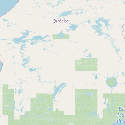
      Sedro-Woolley, Washington, United States

      Related Distances from Sedro-Woolley

      CitiesDistance
      Sedro-Woolley to San Francisco743.20 mi (1,196.07 km)
      Sedro-Woolley to Las Vegas918.88 mi (1,478.80 km)
      Sedro-Woolley to Los Angeles1,014.02 mi (1,631.90 km)
      Sedro-Woolley to Riverside1,037.26 mi (1,669.30 km)
      Sedro-Woolley to Denver1,047.80 mi (1,686.27 km)
      Sedro-Woolley to San Diego1,115.32 mi (1,794.94 km)
      Sedro-Woolley to Phoenix1,157.27 mi (1,862.45 km)
      Sedro-Woolley to Minneapolis1,384.62 mi (2,228.33 km)
      Sedro-Woolley to Dallas1,706.65 mi (2,746.59 km)
      Sedro-Woolley to St. Louis1,724.46 mi (2,775.26 km)
      Sedro-Woolley to Chicago1,728.38 mi (2,781.56 km)
      Sedro-Woolley to Houston1,916.27 mi (3,083.93 km)
      Sedro-Woolley to Detroit1,921.16 mi (3,091.81 km)
      Sedro-Woolley to Atlanta2,185.65 mi (3,517.46 km)
      Sedro-Woolley to Washington2,316.63 mi (3,728.26 km)
      Sedro-Woolley to Baltimore2,320.61 mi (3,734.67 km)
      Sedro-Woolley to Philadelphia2,363.50 mi (3,803.69 km)
      Sedro-Woolley to New York2,394.99 mi (3,854.36 km)
      Sedro-Woolley to Brooklyn2,395.37 mi (3,854.98 km)
      Sedro-Woolley to Queens2,398.90 mi (3,860.65 km)
      Sedro-Woolley to Boston2,469.81 mi (3,974.78 km)
      Sedro-Woolley to Portland206.43 mi (332.22 km)
      Sedro-Woolley to Tampa2,540.15 mi (4,087.97 km)
      Sedro-Woolley to Miami2,745.59 mi (4,418.59 km)
      Sedro-Woolley to Seattle61.65 mi (99.21 km)

      New York, New York, United States

      Related Distances to New York

      CitiesDistance
      Chicago to New York718.27 mi (1,155.95 km)
      Atlanta to New York749.27 mi (1,205.83 km)
      St. Louis to New York878.27 mi (1,413.45 km)
      Orlando to New York942.64 mi (1,517.04 km)
      Tampa to New York1,001.86 mi (1,612.33 km)
      Minneapolis to New York1,020.72 mi (1,642.69 km)
      Miami to New York1,091.55 mi (1,756.69 km)
      Queens to New York7.69 mi (12.38 km)
      Philadelphia to New York79.39 mi (127.77 km)
      Dallas to New York1,372.19 mi (2,208.33 km)
      Houston to New York1,420.65 mi (2,286.31 km)
      Denver to New York1,625.51 mi (2,616.00 km)
      Baltimore to New York171.68 mi (276.28 km)
      Boston to New York184.88 mi (297.54 km)
      Phoenix to New York2,141.27 mi (3,446.04 km)
      Las Vegas to New York2,236.88 mi (3,599.91 km)
      Seattle to New York2,405.80 mi (3,871.76 km)
      Riverside to New York2,408.71 mi (3,876.45 km)
      San Diego to New York2,426.57 mi (3,905.19 km)
      Portland to New York2,442.06 mi (3,930.12 km)
      Los Angeles to New York2,456.66 mi (3,953.62 km)
      Brooklyn to New York3.32 mi (5.34 km)
      Washington to New York205.45 mi (330.64 km)
      San Francisco to New York2,571.87 mi (4,139.03 km)
      Detroit to New York488.50 mi (786.16 km)